
Thanks for reading some of the latest features about area people and events.
To view every page and read every word of The Kenmare News each week,
subscribe to our ONLINE EDITION!
Super saturated
Across the state, east to west, north to south, North Dakotans are suffering the misery of swollen waterways, flooded roads, water seeping into homes and businesses, and saturated fields.
6/01/11 (Wed)
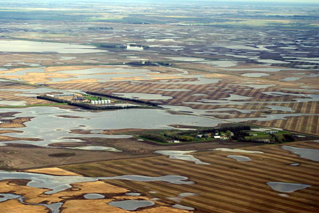
As much water as tillable acres . . . The above photo shows water standing in fields surrounding farmsteads northwest of Tolley and
just south of Highway 5. Pictured lower right is the Bruce Hanson
farmstead. At left center is the Conrad Petersen farm. The
Palmer Brekhus farm can also be seen above and to the right
of Petersens'. The water poses an impossible challenge to
many farmers in the area who are up against crop
insurance planting deadlines, which have approached
or already passed for various crops.
A vacant fire southwest of Tolley.
By Terry Froseth
Across the state, east to west, north to south, North Dakotans are suffering the misery of swollen waterways, flooded roads, water seeping into homes and businesses, and saturated fields.
The problems associated with being too wet started early this spring, actually carrying over from last fall.
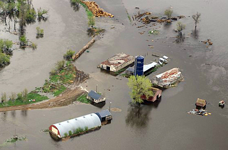
Thousands of homeowners, cabin owners, and businesses are suffering losses from water damage. Farmers are being hit especially hard.
Many farmers of the area are looking at more standing water than tillable acres as planting deadlines pass them by.
The Agriculture Department says that only about 15% of spring wheat, 14% of corn, 8% of canola, 6% of barley, 3% of durum wheat and 2% of soybeans have been planted in North Dakota as of May 17. And, there have been precious few dry days in the state since the 17th.
To compound the problems, runoff from Canada to the north and the Montana to the west, is expected to continue for weeks. Also, heavy rains have been unrelenting.
Dams and reservoirs in North Dakota, Saskatchewan, and Montana are at capacity so releases of water being held back by those structures will have to increase during the coming days and weeks.
Each of the state’s major cities have dealt with flooding issues this year, and Minot and Bismarck are currently in the midst of their biggest flood battles in years.
An aerial view is the best perspective for gauging the enormity of the problem.
The photographs published on the front page and page 10 of this issue show the impact of the saturation on just one small area of the state.
The pictures were taken on May 22nd by Bill Broghammer while flying with his father-in-law, Kenny Brekhus, in the area surrounding Kenmare, Tolley, and Mouse River Park. See more photos HERE.
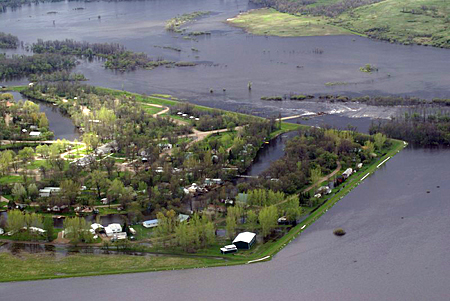
Mouse River Park becomes an island . . . Water threatens to spill
over the levee along the north and west boundaries (bottom of photo)
of Mouse River Park. To the right of center of the photo, water
completely covers the roadway entering the Park from the west.
Standing water can also be seen in many
of the cabin yards along the levee.
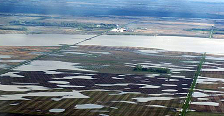
This photo taken from west of Tolley gives the town the
appearance of being lakefront property. The railroad tracks
can be seen extending west through the water.